Explore Switzerland's Alpine Trails with Confidence
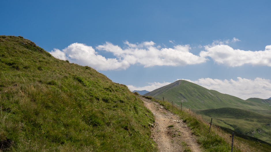
Alpavero is your dedicated platform for planning hiking adventures across Switzerland's most breathtaking mountain landscapes. Whether you're navigating the rugged ridgelines of the Bernese Oberland or following the gentle meadow paths of Appenzell, we provide the detailed route data you need to make informed decisions before you lace up your boots. Our trail database covers hundreds of verified routes, each assessed for difficulty, elevation gain, and seasonal accessibility. We combine satellite topography with on-the-ground contributor knowledge to give you the most accurate picture of what to expect on the trail. From day hikes to multi-stage alpine traverses, Alpavero helps every hiker — beginner or experienced — move through Switzerland's mountains with clarity and confidence.
Trail Planning Tools
Difficulty Assessment
Every trail in our database is rated using a standardised difficulty scale that accounts for gradient, path surface, exposure, and cumulative elevation gain. Our assessments are reviewed by experienced alpine guides to ensure they reflect real conditions rather than optimistic estimates. This helps you choose routes that genuinely match your fitness level and experience.
Elevation Tracking
Detailed elevation profiles are available for every route, showing ascent and descent broken down by trail segment so you can pace your journey accurately. Our interactive elevation charts let you identify steep sections in advance and plan rest points accordingly. Data is sourced from high-resolution topographic surveys updated annually.
Seasonal Accessibility
Alpine trails change dramatically with the seasons — snow closures, stream crossings, and unstable terrain can make a summer route hazardous in spring or autumn. Alpavero provides monthly accessibility indicators for each trail based on historical conditions and current-year snowpack data. We also flag routes that require additional equipment such as crampons or trekking poles during shoulder seasons.
Route Discovery
Scenic Destinations
Alpavero curates collections of Switzerland's most visually rewarding hiking destinations, from the turquoise glacial lakes of Graubünden to the panoramic ridges above Lake Geneva. Each destination page includes route recommendations sorted by difficulty, estimated hiking time, and best-season windows. We update our featured destinations quarterly to reflect trail condition reports from our contributor network.
Multi-Stage Route Guides
For hikers planning extended adventures, we offer detailed guides for Switzerland's iconic long-distance routes including sections of the Alpine Pass Route and the Via Alpina. Each guide breaks the route into daily stages with accommodation suggestions, water source locations, and emergency exit options. Our stage-by-stage format allows you to adjust your itinerary flexibly as conditions change.
Contributor Trail Reports
Real-time trail condition reports submitted by Alpavero community members give you ground-level insights that no satellite map can provide. Reports include path surface conditions, wildlife sightings, hut opening status, and recent weather impacts. Each report is timestamped and geotagged so you always know how recent and location-specific the information is.
Safety & Preparedness
Alpine Safety Guidelines
Alpavero provides route-specific safety briefings written in collaboration with Swiss mountain rescue organisations. These briefings cover common hazards for each trail type, recommended gear lists, and protocols for changing weather conditions. Understanding the risks before you depart is the single most effective way to prevent emergencies in the mountains.
Emergency Preparedness
Each route page includes emergency contact information for the relevant cantonal rescue services and the locations of the nearest mountain huts with phone access. We also provide downloadable offline maps so you retain navigation capability without mobile coverage. Alpavero strongly encourages all hikers to register their planned routes with a trusted contact before departure.
Weather Integration
Integrated weather forecasts from MeteoSwiss are displayed on each trail page, showing conditions at both the trailhead elevation and the summit or high point of the route. We highlight days when thunderstorm probability exceeds safe thresholds for exposed ridgeline hiking. Planning around reliable weather windows is one of the most impactful decisions a hiker in the Alps can make.